Sunday, August 11, 2019

Ending Phase III: Trout River to Channel Port aux Baxque


8/11/19

It has been nine days since my last Blog. Poor internet and fatigue have contributed to my dereliction and certainly not lack of interesting scenery and events.

We left Trout River in pouring rain but it had cleared and was lovely when we arrived at Zensville Campground at Kippens. This means that we left the Gros Morne area and traveled south toward Port aux Basque (the Ferry port). Kippens is near Stephensville which hosted a large USAF Base until the 1960’s. It is the start of the Port au Port Bay loop which we wanted to drive.  Our campground was very pleasant with grass and mature trees. A path across the road led to a beautiful beach where Bonnie could run off-leash. We also re-met a couple here that we met in Alaska in 2016. The world of retired RV travelers is a small one!

Late afternoon walk on the beach.
After nearly a month of staggering beauty we felt sort of jaded and embarked on the Port au Port Bay trip with diminished enthusiasm. Oh My Goodness! More and very different amazement was in store for us. Wonderful rock walls and gorgeous high cliffs overlooking the sea which was every shade of turquoise and blue imaginable. We walked to a charming waterfall that spread out onto a flat rock ledge before pouring into the sea. We stopped at the Park at Cape St. John   and ate fresh bread cooked on a open oven by the teenagers there who are on government grants to preserve the culture.  Another peak day.


The breadmakers

The bread oven
We moved on from Zensville traveling to Great Codroy CG in the Codroy valley. It was only two hours so we arrived by lunch time. This park used to be a provincial park but is now owned and operated by the same family that originally donated the land to the Canadian government. They are totally dedicated to hospitality and the reviews call this the best campground in NFL. They may be right. We stayed three nights and it was such a pleasure.

After setting up, we took Bonnie and started looking for a beach. We made another loop drive this one around the Codroy Valley and out to Cape Anquille. The campground host had told us about the wide sandy beaches at Searston and Bonnie loved them. The campground host built a nice campfire every night and it was fun to stop in and get to meet other folks who were coming and going to/from NFL.

Lighthouse at Cape Anquille

The "Inspiration Trail"


Channel Port aux Basque is the ferry port and we had whipped in and out of it previously. We wanted to go back and explore the Southwest Coast before we left.  After buying a few groceries we took Rt 407 along the coast to Rose Blanche where the road ends. There is a passenger ferry there that serves the communities along the coast but are no roads in this area. Again we were astonished by the difference in the terrain. Now we were in granite mountains with almost grotesque knobs, promontories, and formations with patches of bright green tundra and thousands of ponds and waterways.  What looks like grass is actually a kind of lichen growing on a thin peat bog and it is full of tiny orchids and pitcher plants.
Pond and Bog on top of a mountain

Another mountain top pond

We followed an almost mile long boardwalk to a waterfall. The waterfall was nice, but the walk across the bogs was amazing.  I got so excited seeing a bog orchid that I stepped off the path and got my foot wet. Within five more steps, the orchids were everywhere! For our last day in NFL this was an astonishing experience. The wonderment and awe just kept on happening.


This boardwalk is almost a mile long.


Bog Orchid

Exactly like our Deer Moss...but much smaller.

Another type of orchid

Looked like our yellow fringed orchid but not sure.

Tiny, whispy yellow flowersl Very delicate

A milkweed? Don't know, but it is lovely.


On Friday, we boarded the ferry to North Sydney.


Monday, August 5, 2019

AWE (wonder, amazement, astonishment) STRUCK (smacked, socked, walloped, clobbered) at GROS MORNE


August 5, 2019:


 Gros Morne means “Great Somber” and is named for the big mountain standing alone in the midst of all this grandeur. There is literally no other place like it in the world. Because of its unique status it is not only a Canadian National Park but also a UNESCO World Heritage Site. It is the place where ancient continents  collided and left evidence to prove the theory of plate tectonics and the geological differences in the various “arms”, fjords, seashores, terrain, and mountains is astounding.

Heading west from Grand Falls-Windsor we started with a beautiful cloudless sky but the closer we got to the Western Shore, the darker it got. By the time we turned north at Deer Lake it had become cold and drizzly with high winds. I had not made reservations thinking in some vague way that we would stay in Shoal Brook as we did in 2008.
Water’s Edge, in Shoal Brook, did have a vacancy but things had gone downhill there in 11 years.  They could only offer 15amp electric and non-potable water. We pushed on and found ourselves crossing the Tablelands region of Gros Morne in a high wind. What a relief when we reached Elephant Head Campground in Trout River. They had plenty of spaces, a nearly new park, and 3-way hookups. We stayed there a week!


Trout River is a lively little municipality surrounded by Gros Morne National Park. There is a lovely NP campground there also but it is deeply wooded and has no facilities.  We strongly suspected that the bugs would be bad and later met some campers who confirmed our fears. In NFL it is always best to camp out in the bald open spaces no matter how attractive those shady spots look.


Next day we were off to the Discovery Center for the Tablelands at Gros Morne. This is the best national park interpretive center ever, in either the US or Canada. In 2008 we spent hours here and did so again this time. I bought a new book, Rocks Adrift: the Geology of Gros Morne National Park, to add to our collection and we set out to look at rocks.  We began by exploring the area around Trout River, Woody Point, and the Tablelands by jeep and with short walks.  I walked the Serpentine Trail and saw tons of serpentine (duh), as well as fields of flowers including pitcher plants, bog orchids and oodles of others that I did not recognize. This is always the case in NFL, the quantity and variety of wild flowers is staggering.


Other sites on our list were Lobster Cove Head, Green Point, Green Gardens, and Trout River/Pond. Over the next few days we were able to spend lots of quality time at each of them and saw marvelous things! In every case the wildflowers vied for attention with the geological formations.

Lobster Cove: Where the "impossible" combinations of rocks and fossils confirmed plate techtonics 


The meadow about Green Point.

Green Point where you can "read" the history of the earth over millions of years


Turn these vertical cliffs on their side and the layers tell a story. Just like tree rings.

These cliffs were flat plates of sea bed.


Since we are limited in the distance we can hike, we were so fortunate to find two local fishermen who were willing to take us out in their boats. We went all the way to the end of Trout River/Pond with George and his neighbor, Alan, in George’s Bayliner. Then, Alan took us out on the ocean in his fishing boat to see Green Gardens and the cliffs and caves along the coast. They were both very knowledgeable and made the trips up close and personal. Alan also gave us a mess of fresh cod fillets that were out of this world.
Trout River/Pond is actually a fjord

The backside of the Tablelands from Trout River/Pond

Green Gardens from the Atlantic side


Our last day in Trout River we attended the Bang Belly Pudding Festival. BBP is a kind of bread pudding made from an assortment of ingredients. After the official “judging”, we sampled the entries. It was actually pretty good! We loved the music and the opportunity to visit with local folks.


We left Trout River yesterday morning in pouring rain and high wind but the weather improved considerably when we reached Kippens. We were even able to let Bonnie run on the beach last night. 


Thursday, August 1, 2019

From St. John's to the Western Shore: Traveling in NFL


August 1, 2019

We have  reservations for our return to the mainland on August 9, so we only have eight more days on the Island. We have had unusually good weather for this part of the world and have been able to do more than we anticipated. We are now on the Western Shore at Gros Morne National Park and getting here has been so much  fun.

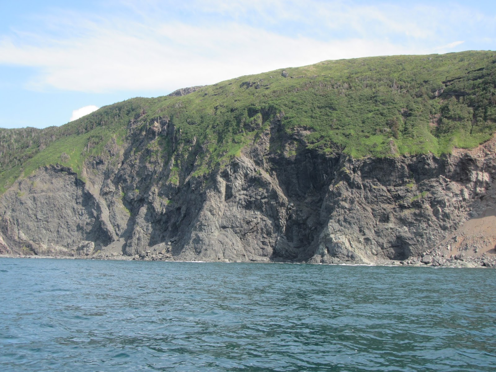
When we finished the loop for the southeastern “arm” of the Avalon Peninsula we wound up at Celtic Rendezvous, a small resort on the Atlantic Coast about 20 miles south of St. John’s.  The campground has only 20 spaces but is located on the top of a cliff overlooking the Witless Bay Ecological Reserve.  Just offshore are small islands that are seabird refuges, mostly Puffins.  Since the capelin (fish) attracts both birds and whales we had a lot to look at. One day we took a small boat tour around the Reserve and were immersed in Puffins! They were in the water, in the air, on the rocks…..everywhere. Everybody loves Puffins and we do too.
Puffin Rookery at Witless Bay
St. John’s is a good sized city with beautiful old buildings. It reminded me of Glasgow with its long hilly streets and tightly-packed town houses. The downtown and the harbor are very busy and parking is difficult. We did manage to have lunch in the old city before going to the museum. Called the Rooms, the building itself is a marvel and the exhibits are first-class. I finally got to see the fossil collection from Mistaken Point (and elsewhere in NFL). Cape Spear is not far from St. John's and since we didn't want to miss seeing the most northeasterly spot in North America, we had a very long day!

From Cape Spear to Europe

WWII Bunker on Cape Spear

Leaving the Eastern Shore we retraced our route on the TCH to Clerenville and turned north on to the Bonavista Peninsula. Everyone we met was so enthusiastic about it, so we went. 

Our campsite, at Cabot Lake RV Park, was on a small lake that emptied into a larger one. We were right beside the lake near a perfect little canoe launch, The setting was excellent but the facilities were not great and the weather was iffy.  We did stay a few days to give us a chance to explore the area. We visited Trinity, a charming village with lots of historical buildings and tons of tourists. We encountered our first tour bus here. 

One the positive side, we missed a turn on the way to the town of Bonavista and traveled on a secondary road where we saw several moose. We went to Cape Francis to see where Cabot landed and hit the jackpot by seeing The Dungeons Provincial Park. There were also lots of whales playing in the bay around the cape. We enjoyed the Bonavista Peninsula and I’m glad we went. That said, it now goes into the “Been There – Seen That” bucket.
Cabot statue at Cape Francis

Moose

Campsite at Cabot Lake

Bonnie meets a Moose
Back on the TCH we made sure to stop in Gander at the North Atlantic Aviation Museum. Newfoundland has a deep history in the aviation world and also in the birth of electronic communications. In the previous weeks we had visited a number of stark and windy outposts where early aviators waited to cross the Atlantic and/or lonely telegraph operator’s maintained stations. The Aviation museum had excellent exhibits but the most moving were the 911 artifacts. "When the World Came to Gander". 


The Central Section of NFL doesn't seem as sexy as the coasts but last spring I read an excellent book, The River Thieves, about the demise of the Boetuck people, which occurred at Red Indian Lake south of Badger. The Exploits River is the longest river in NFL and flows from the Red Indian Lake to Exploits Bay. It was a major transportation link for European explorers and settlers and enabled the Boetucks to be hunted down and killed. As a result, I was interested in this area and in the Exploits River.

 We camped at Brookdale RV in Bishop’s Falls for a few days.  Our assigned site was wooded and private but it was too far from level for us to use it. There is only so far that you can go with a camper and plastic leveling blocks and that does not include two feet off the ground in front and 18” on the sides! The manager let us choose a spot and our choice was the middle of a gravel parking lot. By now we have learned that in this country trees equal bugs, vicious bugs. It was a nice place though with excellent trails to walk Bonnie.

First, we went whitewater rafting through the Exploits River Gorge. It was just Butch and I with the guide (Ryan) and a safety boater (Mitch) both 19 year old college students. They were great guys, full of youthful enthusiasm but not experienced on any whitewater except this section of the Exploits. The put-in was unbelievable! Picture rough cut stone "steps" (sort of) down a steep incline to a 500 yard boulder field (no defined path) to a "splash in" entry to the river. That means we were to jump into the river, then crawl into the raft. We declined and eased our way between two boulders instead. The raft, safety ducky, and all the gear was transported into the gorge via a zip line. The raft was too short (about 10 feet) for this type of whitewater and the "safety" boat was an Aire ducky. Off we Go! The Gorge itself was  a short run, less than two miles,  but it was fast, high volume water with big wave trains and lots of technical stuff. Our guide fell out at the first rapid. Butch had to bend his bionic knee at an odd angle, and I had no idea which line we should follow but was paddling like mad.


Ryan pulled himself into the raft, we achieved an eddy. The guys were obviously anxious. Here they were with two old folks and the river was higher and pushier than they anticipated. They called their boss. Butch and I were fine. They decided to strap the safety boat on the raft and put Mitch in with us. I would not have done that but I wasn't calling the shots. We sailed through the rest of the rapids with no problem. Snapped the eddies and punched through the waves.  Butch was able to paddle just as aggressively from the floor and I am old but strong. They invited us to join them next day at half price! Their business needs work but I hope they are successful.  


While at Bishop’s Falls, we went to Botwood to see the seaplane memorial and made a loop out to Fortune Harbor, following the Bay of Exploits. We also hiked the Gorge the  to see where we had been. Our last day we took a long ride southwest of Grand Falls-Windsor to the community of Buchans, a former mining town that now looks like a near-abandoned military base  Since we had a jeep, we were able to take a mining company road out to the bridge that crosses the Exploits River near Red Indian Lake. We had now followed the Exploits from its source to its confluence with the ocean. 

On the road again, we drove back to Deer Lake and made the turn north to revisit fabulous Gros Morne.